
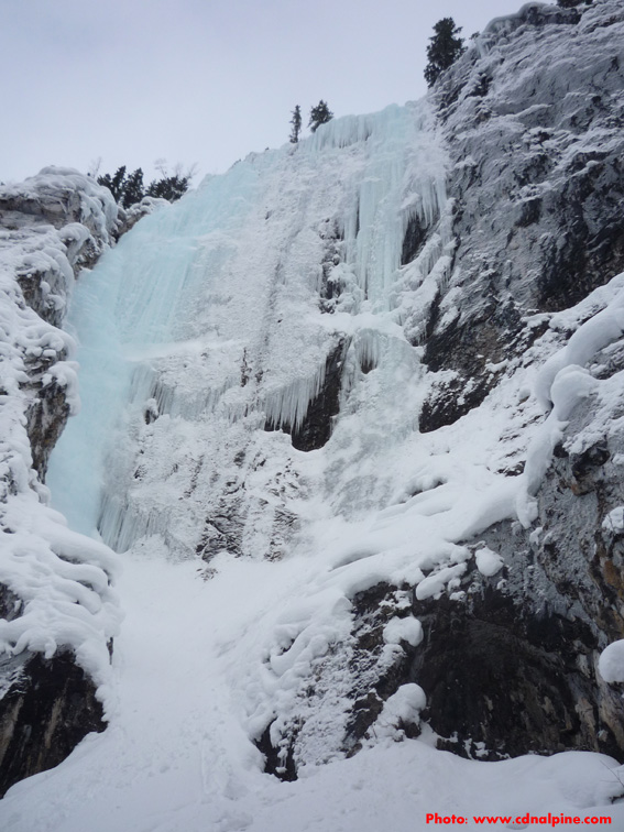
 click to enlarge…
Iron Curtain is the main curtain, as well as the strip on the right. Grovelling Gully (W3) climbs the low angle ice on the left edge of the flow.
Grade: Iron Curtain (III, WI6); Grovelling (II, WI3); Peristroika (III, WI4+)
Route Length: 85m (Iron C. & Grovelling); 50m (Peristroika)
Approach: Park in the lot at the start of the Yoho Valley Road (Takkakaw Falls road) just east of Field. The road is closed in the winter. Hike, ski, or snowshoe up the road past The Pillars and L’Arimas de Alegriauntil Iron Curtain is visible to the left of a large avalanche path which also has some ice in it (not recommended). About an hour. Head up through the trees left of the avalanche path for another half hour to the climbs.
Route Descriptions:
Iron Curtain (WI6, 85m): The main reason for going to this area. The climbing is steep and the ice is usually very chandeliered making it hard to get solid tool placements & screws. Both the main flow and the narrow strip just to the right have been climbed. The narrow strip may actually be “Iron Sliver (WI6)”.
Grovelling Gully (WI3, 90m): The lower angled ice at the left edge of the Iron Curtain. Often wet.
Peristroika (WI4+, 50m): The narrow route about 30 meters right of Iron Curtain. A short bit of sketchy mixed climbing may be required to reach the ledge at the start of the climb.
 click to enlarge…
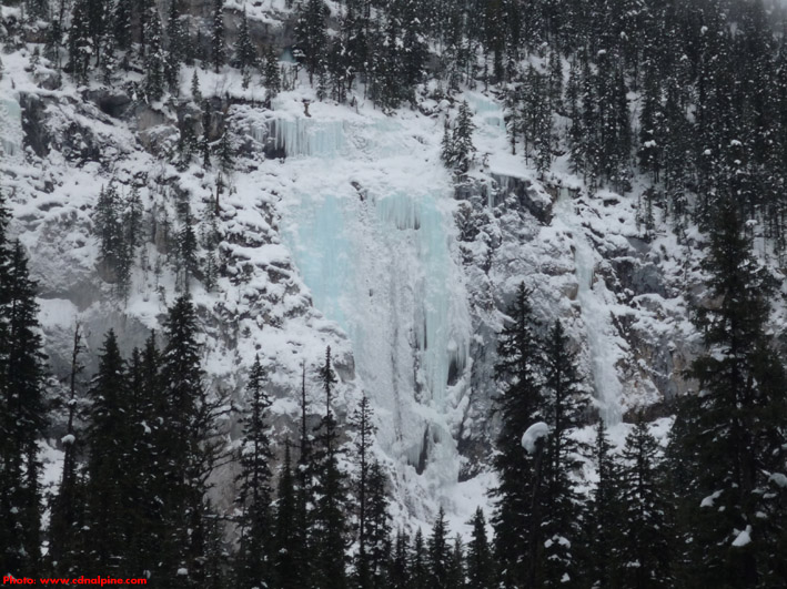
Iron Curtain on the left, and Peristroika on the right.
Descent: Rappel the routes.
Gear: Screws.
Objective Hazards: With careful routefinding on the approach, it is possible to avoid any avalanche hazard.